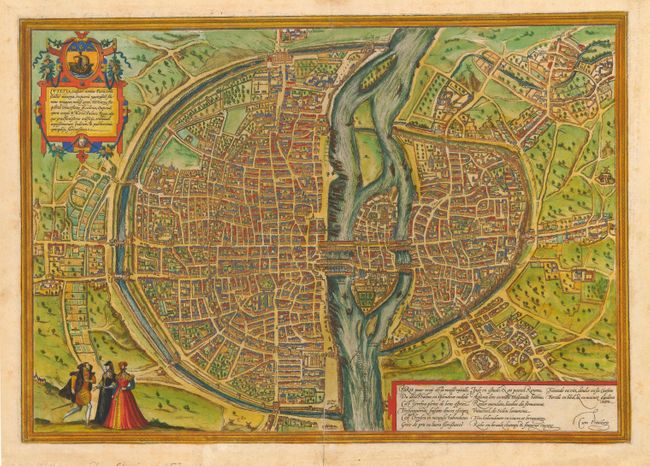
Subject: France - Paris
Period: 1572 (circa)
Publication: Civitates Orbis Terrarum
Color: Hand Color
Size:
19 x 13.5 inches
48.3 x 34.3 cm
This great city plan is based on Sebastian Munster's map of 1569. Paris began as a small settlement on an island in the Seine, named Lutetia by the Gallii Parisii. This island, seen at the center of the map, controlled the trade in the region both along the river and via the north-south roads crossing the island. The city grew through successive periods, with walls, citadels, and forts added through a series of expansions. The Bastille is shown at the upper center of the engraving and the great Notre-Dame cathedral is on the eastern end of on the island. The plan is oriented with north on the left. Latin text on verso.
References: Goss (Cities) #44.
Condition: B
Lovely old color. Soil in margins with old repairs on minor fold separations. Remnants of hinge tape on verso.