Subject: World
Period: 1748 (dated)
Publication:
Color: Hand Color
Size:
27.3 x 19.7 inches
69.3 x 50 cm
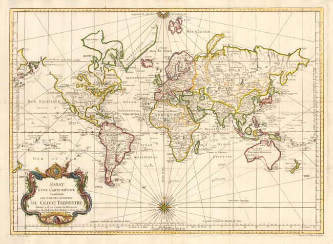
A very large world chart on Mercator's projection. North America is shown with a Fl. de l' Ouest connecting through a series of rivers and lakes from Lake Superior to the Pacific - representing the elusive the Northwest Passage. The Russian discoveries in the North Pacific show Alaska as an island named I. Unamak. Australia is labeled Nouvelle Hollande with Terre de Diemen linked to the mainland. New Zealand is fully formed and there are numerous islands in the Pacific. Large, decorative title cartouche and two fine compass roses with rhumb lines make this a very attractive chart. As Australia and New Zealand reflect the discoveries of Capt. Cook, the published date of this example would be after 1770.
References:
Condition: A
Fine impression and bright hand coloring on thick hand laid paper. Issued folding, now pressed with tiny loss at two fold intersections, still very good.