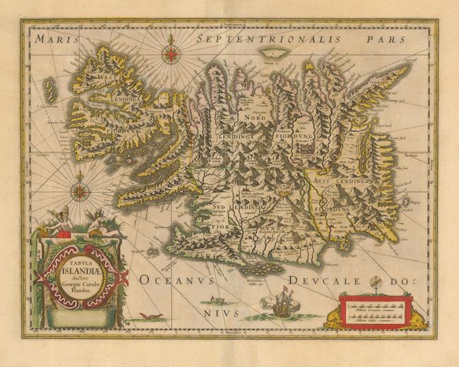
Subject: Iceland
Period: 1647 (circa)
Publication: Atlas Novus, sive Theatrum Orbis Terrarum
Color: Hand Color
Size:
19.3 x 14.8 inches
49 x 37.6 cm
This handsome map of Iceland was based on information from a Dutch navigator named Joris Carolus in about 1620. The map shows the influence of both versions of Bishop Gudbrandur's previous maps, a coastline resembling the Ortelius version, and Mercator's selection and spelling of many place names. The island's topography is dominated by huge mountains and volcanoes and its shoreline is a rugged labyrinth of fiords. It is richly embellished with title and distance scale cartouches, compass roses, rhumb lines, a sailing ship and two sea monsters. The map was hugely influential for over 130 years as it was printed in many editions by two of the largest map publishers in the Netherlands, Willem Blaeu and Jan Jansson. This being the later state without imprint. French text on verso.
References:
Condition: B
Original color with light toning and some extraneous creases along centerfold.