Catalog Archive
Auction 113, Lot 366

"Carte Reduite d'une partie de l'Ocean Atlantique ou Occidental", Depot de la Marine

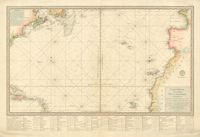
Subject: Atlantic Ocean

Period: 1775 (dated)

Publication:

Color: Hand Color

Size:
32.3 x 18.8 inches
82 x 47.8 cm
Download High Resolution Image
(or just click on image to launch the Zoom viewer)

This wonderful sea chart was prepared by Jean Rene Antoine, Marquis de Verdun de la Crenne and published in a special edition to illustrate the "America War" in 1778. The chart covers the Atlantic from France to Newfoundland and New England in the north and from Africa and the Cape Verde Islands to the coast of Cuba in the south. It provides nice detail of the islands and the coastlines. French text at bottom providing coordinates for major islands and cities.

References:

Condition: A

Good impression printed on heavy paper with attractive color. Bit of very minor soil, still very good.

Estimate: $450 - $550

Sold for: $325

Closed on 12/7/2005

Archived