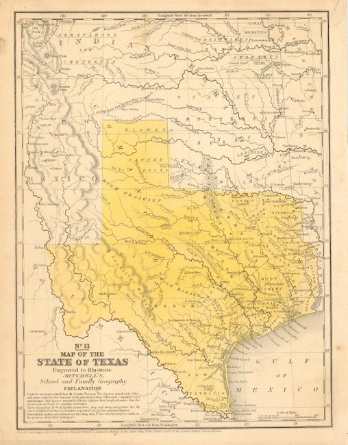
Subject: Texas
Period: 1850 (circa)
Publication: Mitchell's School and Family Geography
Color: Hand Color
Size:
8 x 10.5 inches
20.3 x 26.7 cm
Nice example of an early map to locate Dallas. Texas is here shown with it reduced borders that are close to today's configuration. The larger land area allotted to Texas in 1845 was given back to the United States in 1850. Part of this settlement allowed Texas to retain all public lands within its borders. Details include Indian tribes, watershed, counties, cities and towns, wagon roads or trails, the "Caravan route from Independence to Santa Fe," and more. There are no counties formed west of approximately the 98th meridian. The Staked Plains are not noted, here the region is labeled High Prairies. The hills are shown through hachure. The map is dated 1846 but published circa 1850.
References: Day #1682.
Condition: A
Good original full hand coloring. A few light stains in blank areas outside of main portion of map, still very good.