Subject: Oklahoma
Period: 1903 (published)
Publication: Commission to the Five Civilized Tribes
Color: Printed Color
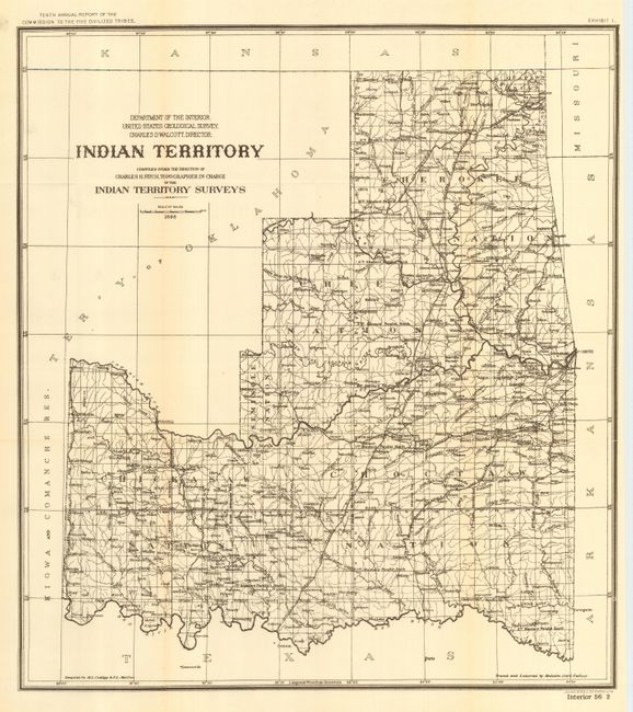
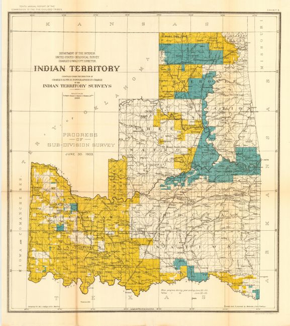
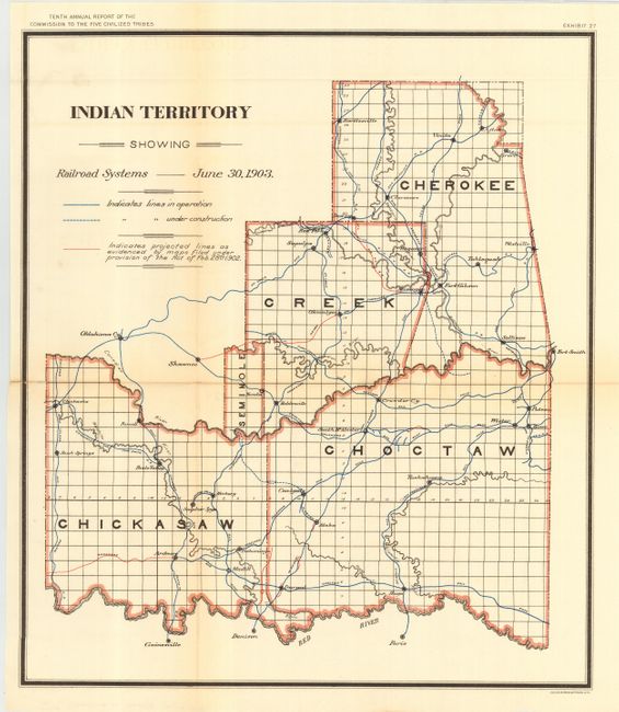
Three maps showing land allotments for individual 'Civilized' Indian tribes, all printed by Bien. The maps were published by the Interior's commission and were included in their Tenth Annual Report. 1) "Indian Territory Compiled under the Direction of Charles H. Fitch, Topographer in Charge of the Indian Territory Surveys" 1898, uncolored (18 x 20"). 2) "Indian Territory……. Progress of Sub-Division Survey June 30, 1903" printed color, (18 x 20"). 3) "Indian Territory Showing the Railroad Systems June 30, 1903" printed color (15.3 x 17.8") shows the boundaries of the Five Civilized Tribes.
The Commission to the Five Civilized Tribes was appointed to negotiate with the Five Tribes for the extinguishment of their tribal title to lands by allotment, and division of the same among the members of the tribes. This commission became known as the Dawes Commission, after Senator Henry L. Dawes, who was largely responsible for the legislation. Their main task was to make an equitable division of nearly twenty million acres of land among more that 100,000 Indians. In 1895 the USGS began to conduct surveys of all lands in Indian Territory into townships, ranges and sections. These maps were used by the Dawes Commission to assist the citizens on the tribal rolls to select their individual plats of land.
References:
Condition: A
All folding, as issued. Hint of toning along some folds and a couple small fold intersection splits, all still very good.