Subject: North Carolina
Period: 1878 (dated)
Publication: HR Doc. No. 196, 47th Cong., 1st Sess.
Color: Printed Color
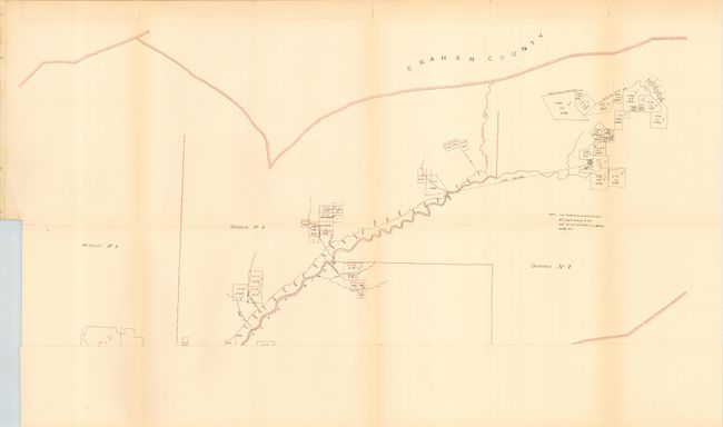
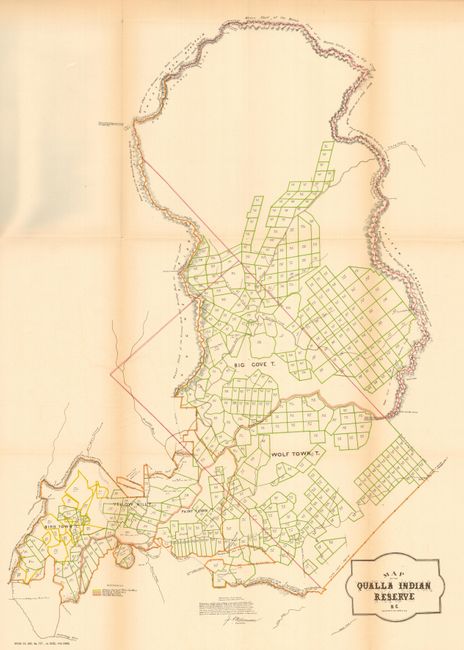
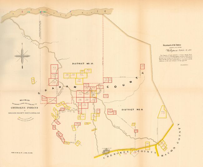
These maps were issued in the detailed report "Eastern Cherokees in North Carolina" that discusses in detail the land titles of the Eastern Cherokees. The maps are: 1) "Map of Districts Nos 1. 5. 6. & 7 in Cherokee County, N. C. Surveyed in 1878 by W. S. Temple U. S. Surveyor" (26.5 x 18"). This map shows the region between Graham and Clay counties. Signed in the plate by J.A. Williamson, Commissioner. 2) "Map of the Qualla Indian Reserve N. C." (16 x 23") details the areas occupied by the Big Cove, Wolf Town, Paint Town, Yellow Hill, and Bid Town Tribes. 3) "Diagram Showing Lands Belonging to Cherokee Indians in Graham County, North Carolina" (14.5 x 18.5"). Complete with the original accompanying 68 pp. U. S. government document of 1882 on the land titles of the Eastern Cherokees.
References:
Condition: A
Folding as issued. All with good impression and coloring. A little light fold toning in a couple areas, still very good.