Subject: Western United States
Period: 1877 (circa)
Publication: Hayden's 12th Annual Report
Color: Black & White
Size:
32.6 x 22.8 inches
82.8 x 57.9 cm
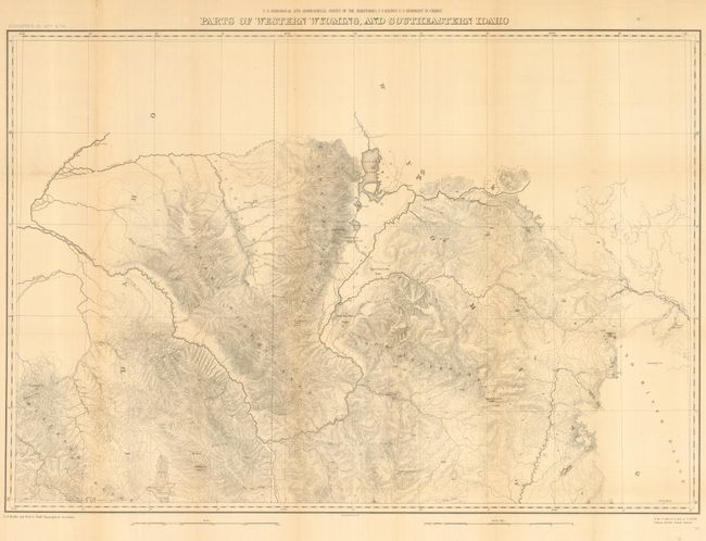
A finely engraved map from the U.S. Geological and Geographical Survey of these western territories that is centered on today's Jackson Hole, Wyoming. Extends to show good detail of Jackson's Jenny and Leigh's lakes, but the area of Yellowstone is completely blank. Names John Gray's Lake, the Blackfoot River, Caribou Mt., Fremont's Pk., To-gwo-tee-a Pass, and much more. It provides a detailed examination of the Snake River and Blackfoot Range in Idaho and the Gros Ventre Mountains and part of the Wind River Range in Wyoming. F.V. Hayden was the geologist in charge of the surveys.
References:
Condition: B
Issued folding, now backed with archival tissue. Trace of toning along vertical folds, else very good to fine.