Subject: Midwest and Mid Atlantic
Period: 1843 (published)
Publication: Geology of New York
Color: Hand Color
Size:
32.5 x 22.8 inches
82.6 x 57.9 cm
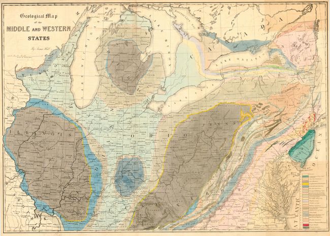
Lovely, colorful geological map by the eminent American geologist James Hall that blends science and the art of cartography. Twenty-two geological formations are named and identified using hand applied colors. The map includes the region of the United States from it's western boundary along the Mississippi River, east to Long Island and the Atlantic. Includes all or parts of Wisconsin, Illinois, Missouri, Kentucky, Virginia, Indiana, Ohio, Michigan, Pennsylvania, New York, New Jersey, Maryland, and Delaware. Shows Lakes Michigan, Huron, Erie and Ontario. Lithographed by Endicott of New York. A nice example of an early and scarce geological map.
References:
Condition: A
Issued folding, now pressed. Small area of darkening at upper right and light offsetting in blank areas near title, still very good.