Subject: World & Continents
Period: 1692 (published)
Publication: Geographia o moderna descripcion del Mundo…
Color: Hand Color
Lovely set of small maps (World, 11 x 5.7"; Continents, 7.5 x 6") decorated with pictorial cartouches, ships and sea monsters. Engraved by Jacob Harrewyn.
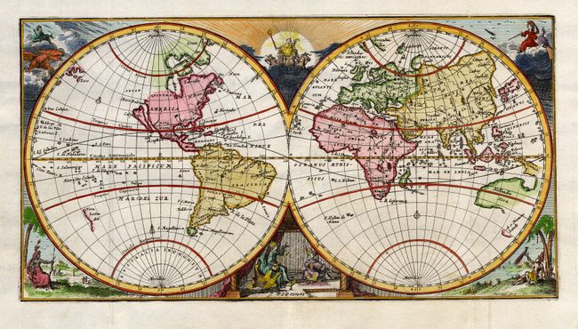
1) The double hemisphere world map shows the island of California with a completely blank Northwest coast of North America, and partially mapped Australia and New Zealand. Allegorical figures fill the corners and cusps between the spheres.
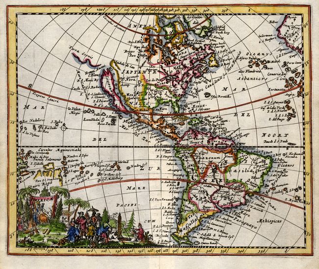
2) The map of the Americas features California as an island with a coastline of Terra Esonis stretching toward Asia. In South America the mythical Lake Parime dominates the region of Guiana. The cartouche features an Amazonian queen and traders buying sugar cane and gold.
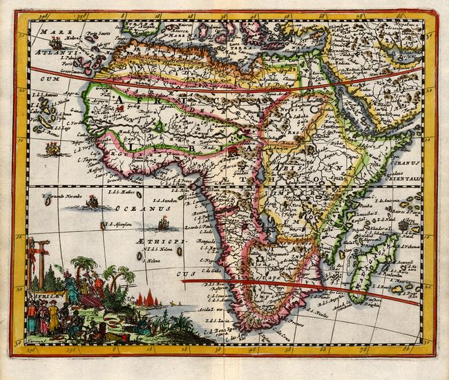
3) The map of Africa features typical 17th century speculative cartography with large rivers and lakes including the twin lake source of the Nile located below the equator. The cartouche includes the pyramids and merchants purchasing ivory, while tiny animals roam the interior and ships sail the seas.
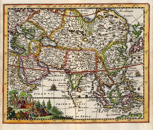
4) Asie includes all of the East Indies and Japan with a disembodied Yedos (Hokkaido) shown above. The cartouche features merchants trading in rich silks and spices.
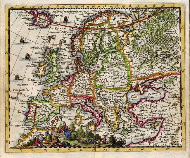
5) Europae extends to include Iceland and shows the major political divisions, while a sea monster and ships ply the Atlantic. The cartouche represents the rich rural landscape of the continent.
References: Map 1, Shirley # 554; Map 2, McLaughlin #110, State 2.
Condition: A+