Subject: United States
Period: 1854 (dated)
Publication:
Color: Hand Color
Size:
27.5 x 16.5 inches
69.9 x 41.9 cm
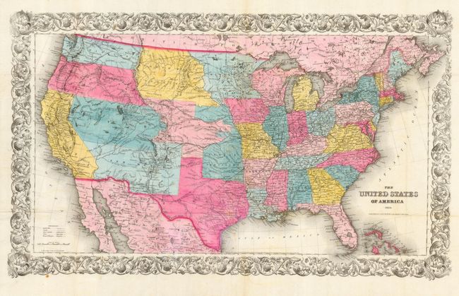
This map features a pre-Gadsden Purchase border and numerous early western territorial boundaries. Washington and Oregon Territories extend to the Northwest Territory at the continental divide. The Northwest Territory in turn extends to the Missouri River where it borders a large Minnesota Territory. Utah Territory spans from California east to join Nebraska Territory along the Rocky Mountains and Continental Divide. The very large New Mexico Territory comprises all of today's Arizona and part of Colorado. The map details the exploration routes of many expeditions including those of Marcy, Kearny, Fremont, etc., and locates the Santa Fe trail. An uncommon issue.
References:
Condition: A
Strong impression and coloring printed on thin banknote style paper with very wide margins. Issued folding. A couple areas of light foxing, water coloring a little mottled, and some watercolor drips in the Sea of Cortez, still very good.