Subject: Colonial Canada and Great Lakes
Period: 1680 (circa)
Publication:
Color: Hand Color
Size:
12 x 8.3 inches
30.5 x 21.1 cm
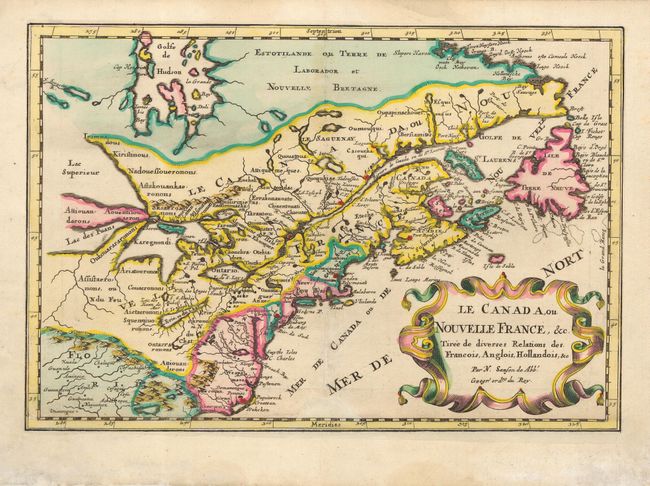
This is a reduced version of one of the most influential seventeenth century maps. It concentrates on the region of greatest French interest and is a keystone map for Great Lakes collections. The most important aspect of the map is the first appearance of L. Erie, ou du Chat as a recognizable lake on an atlas map. This delineation influenced the cartography of the region for over 100 years and was not superceded until De l'Isle's "Carte du Canada" in 1703. The map is also an outstanding source for Indian tribal names and locations. Two names (Aouentsiouaeronons and Attiouandarons) appear here for the first time. The entire Great Lakes basin and the St. Lawrence River is shown in great detail. Lake Superior and Michigan (Lac du Puans) are left open-end to the west.
References: Burden #325; Kershaw #136.
Condition: B
Professional restoration with paper replacement and skilled facsimile of 'meridies' in border at bottom center. In addition the map has been completely remargined - all very professional work.