Catalog Archive
Auction 113, Lot 121
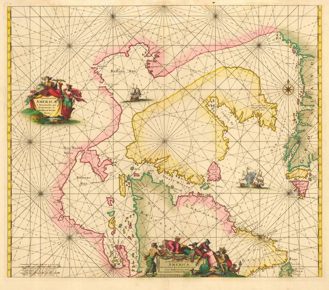
"Septemtrionaliora Americae a Groenlandia, per Freta Davidis, et Hudson, ad Terram Novam / De Noordelyckste Zee kusten van America van Groenland door de Straet Davis ende Straet Hudson tot Terra Neuf", Wit, Frederick de
Subject: Canada and Greenland
Period: 1680 (circa)
Publication: Orbis Maritimus ofte Zee Atlas
Color: Hand Color
Size:
22 x 19 inches
55.9 x 48.3 cm
Download High Resolution Image
(or just click on image to launch the Zoom viewer)
(or just click on image to launch the Zoom viewer)