Catalog Archive
Auction 112, Lot 90

"Americae Borealis Nova Delineatio per Paralle los Circulares", Scherer, Heinrich

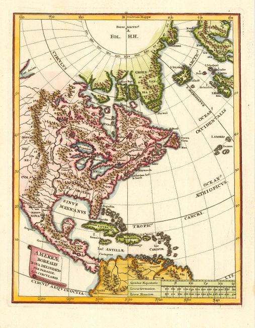
Subject: North America

Period: 1710 (circa)

Publication: Atlas Novus

Color: Hand Color

Size:
7.8 x 9.3 inches
19.8 x 23.6 cm
Download High Resolution Image
(or just click on image to launch the Zoom viewer)

This attractive small map covers the eastern part of North America, extending to the North Pole, Greenland, Iceland and part of Scandinavia. The Great Lakes are prominently depicted and the Mississippi River originates in two large lakes in present-day Canada, and empties into the Sinus Mexicanus too far to the west. The Fret. Anian is shown at the upper left.

References:

Condition: A+

Attractive later color.

Estimate: $400 - $475

Sold for: $325

Closed on 9/28/2005

Archived