Subject: Western Hemisphere
Period: 1600 (circa)
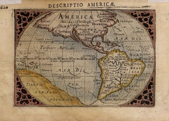
Publication: Tabularum Geographicarum Contractarum
Color: Hand Color
Size:
4.7 x 3.2 inches
11.9 x 8.1 cm
First state of this charming miniature map based on the 1587 folio map by Abraham Ortelius. A notation in North America notes its discovery by Christopher Columbus in 1492. The only place names, Norombega, Granada, and Marata, are all mythical. This map has a convoluted publishing history and it has been attributed to both Cornelis Claesz and Petrus Bertius. It made its appearance in a number of works starting with Claesz' work criticizing the Spanish for their treatment of the Indians. It then appeared in Bertius' revision of Langenes' pocket atlas. Claesz was the publisher for both these works. The title appears above the top border. Title page of the atlas on verso.
References: Burden #92.
Condition: C
Tissue repair including some paper replacement in Terra Australis with loss of some of the engraved letters which have been replaced in pencil. Still an attractive little map. Remnants of hinge tape in top margin.