Subject: North Pacific
Period: 1829 (circa)
Publication: New General Atlas
Color: Hand Color
Size:
23.5 x 19.3 inches
59.7 x 49 cm
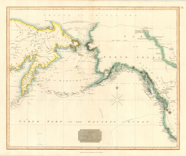
Very informative and large map showing the development of the Alaskan and northwest coastline. Alaska is still a bit misshapen with virtually no interior topography. The tracks of Cook's voyage in 1778 and 1779 are traced and in the Arctic is a note of McKenzie's discoveries including a note where he reported seeing the sea on July 12th, 1789. The watercourse (MacKenzies River) from Slave Lake to the Arctic Sea is shown, along with interesting anecdotal notations (Mountains with bright stones, Strong Bow Indians and According to Indian Report a Sea a short way to the West). Includes great detail of the Pacific coast with the exception of Puget Sound, which is quite tiny. An exceptional example of this chart.
References:
Condition: A+
Beautiful impression and fine hand coloring on thick paper with original margins. Hint of centerfold toning resulting from show through of the backstrap.