Subject: Pacific Ocean
Period: 1798 (dated)
Publication:
Color: Black & White
Size:
19 x 15 inches
48.3 x 38.1 cm
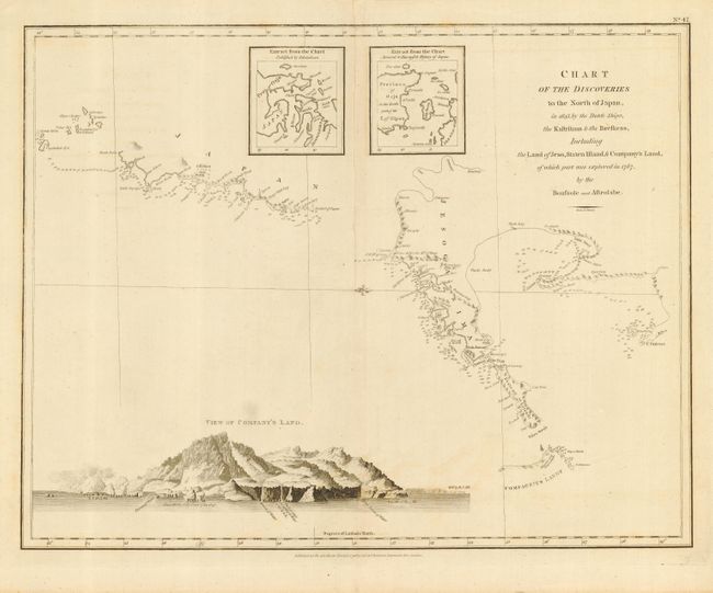
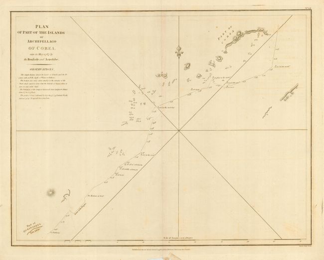
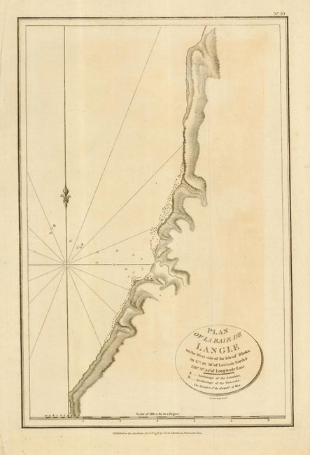
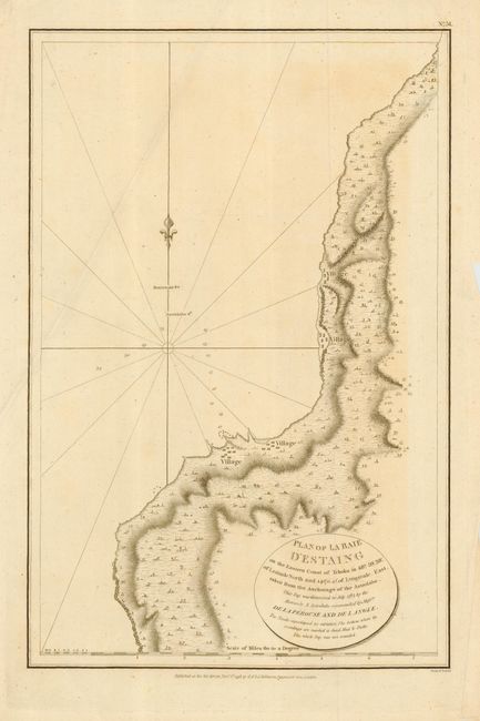
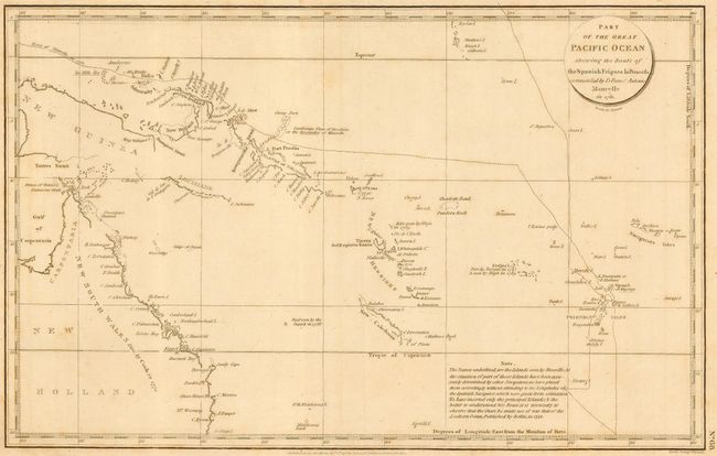
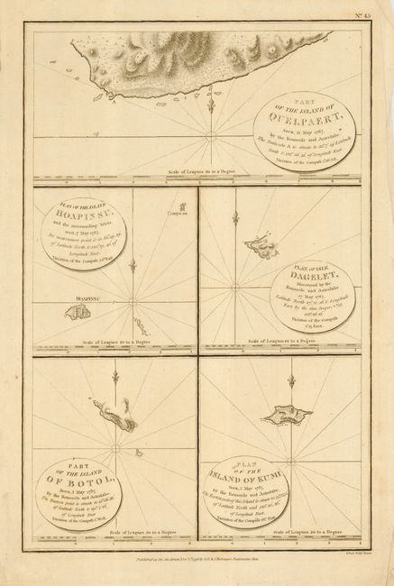
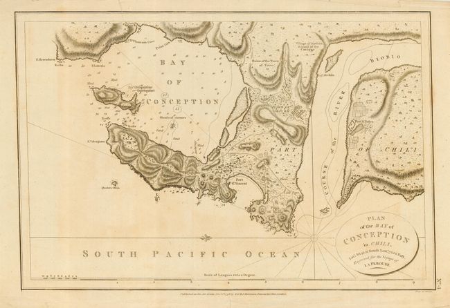
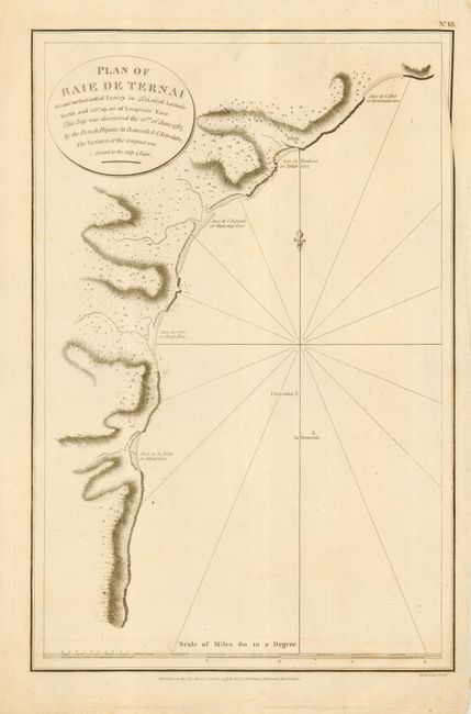
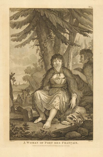
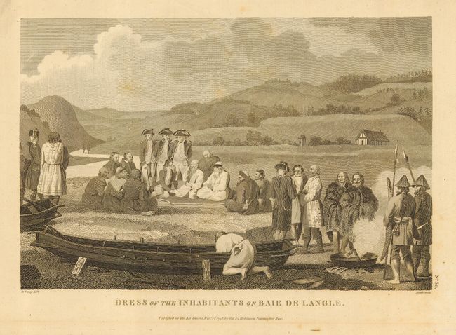
Jean-Francois de Galoup, Comte de La Perouse commanded a French scientific expedition to the Pacific in 1785-88. Recognized as one the foremost naval commanders and navigators in France, he was selected by King Louis XVI to complete Captain James Cook's exploration of the western Pacific. The British Admiralty provided scientific equipment to measure variations in magnetic compass readings and with the latest instruments for determining longitude. La Perouse explored the coasts of the Gulf of Alaska and northwestern North America in search of the fabled Northwest Passage. After leaving America his expedition continued on to Asia where he explored from Macao to Kamchatka and the Solomon Islands in the South Pacific. La Perouse was meticulous in sending copies of his extensive logs, maps and surveying information via other ships as well as overland. La Perouse's last contact was in the spring of 1788 with a British ship in Botany Bay, Australia. The expedition was never heard from again. Considered one of the greatest French voyages, the French Government decided to publish the story of the expedition when it became clear they had been lost. An English edition was published in London.
A fine collection of 8 charts or plans and 2 views from the Robinson, English edition of this famous work. The collection includes: 1) "Chart of the Discoveries to the North of Japan, in 1643, by the Dutch Ships, the Kastikum & the Breskens" (19 x 15"). Includes two insets and large and well rendered "View of Company's Land"; 2) "Plan of Part of the Islands of Archipelago of Corea, seen in May 1787 by the Boussole and Astrolabe" (19.3 x15"); 3) "Plan of la Baie de Langle on the West side of the Isle of Tehoka" (9.5 x 14"); 4) "Plan of La Baie d'Estaing on the Eastern Coast of Tehoka" (9.5 x 14"); 5) "Part of the Great Pacific Ocean shewing the Route of the Spanish Frigate la Princesa commanded by D Franco Antonio Maurelle in 1781" (15 x 9.5"); 6) [Charts of five islands on one sheet] (9.5 x 14.5"). Includes the islands of Quelpaert, Hoapinsu, Dagelet, Botol, and Kum; 7) "Plan of the Bay of Conception in Chili" (14.4 x 9.6"); 8) "Plan of Baie de Ternai" (9.5 x 14.4") 9) "A Woman of Port des Francais" (7.8 x 12.2"); and 10) "Dress of the Inhabitants of Baie de Langle" (11.8 x 8").
References:
Condition: B
All in good to very good condition. Occasional light foxing or toning and some with slightly rough margins.