Subject: North Pole
Period: 1638 (published)
Publication: Newer Atlas
Color: Hand Color
Size:
19.5 x 17 inches
49.5 x 43.2 cm
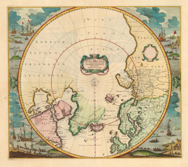
Hondius' important map of the polar region that replaced Mercator's polar map and incorporated much of the knowledge gained by the English in their search for a Northwest Passage to Asia. The North American cartography is based on Henry Briggs depiction of Hudson Bay. Numerous discoveries are shown including those of Frobisher, Davis, Baffin, Hudson, Button, Foxe and James. There are several Dutch names in Labrador, many appearing for the first time on this map. The fascinating whaling scenes that surround the map also depict Dutch activity in the region. Strapwork title cartouche with Hondius' imprint and a second blank dedication cartouche at right. Third state of the plate, and the first to include the whaling scenes. From a German edition with the page number 'B' on verso.
References: Burden #246; Kershaw #98c; Koeman Me 120.
Condition: A
Couple of tiny spots in blank margins. Slight show-through of text on verso.