Subject: Ancient World
Period: 1662 (circa)
Publication:
Color: Hand Color
Size:
20 x 15.5 inches
50.8 x 39.4 cm
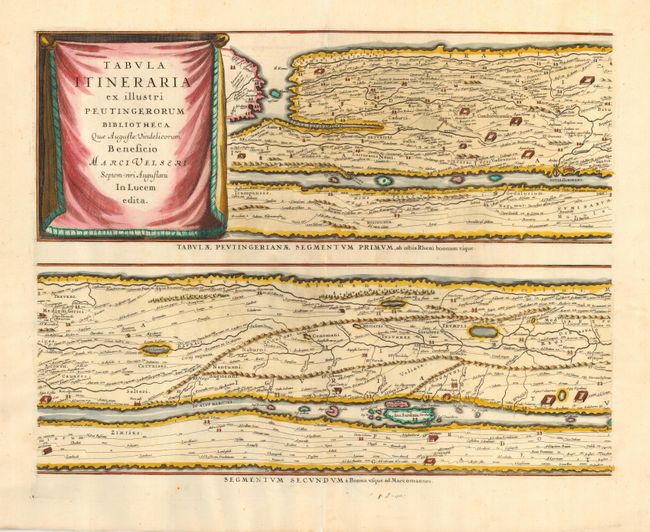
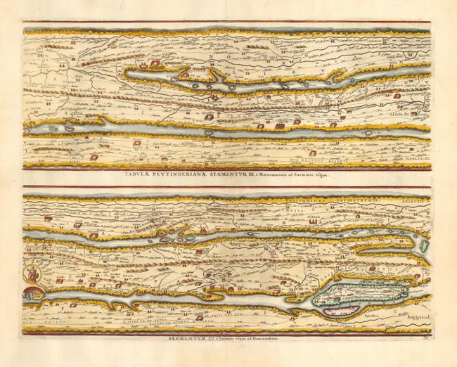
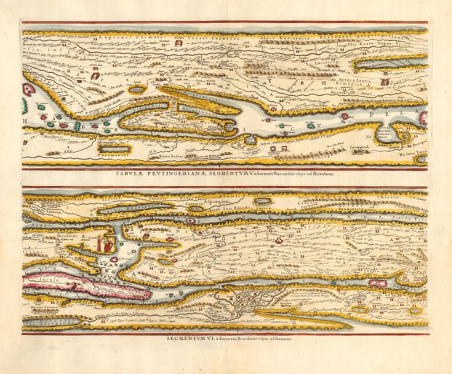
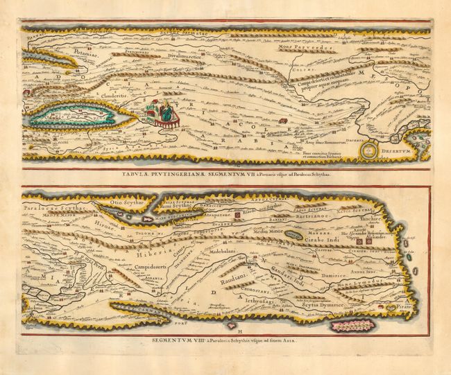
Four sheets making up the famous Peutinger Table, or a Roman road map of the world. In a sequence of four plates, each with two strip maps, the chart depicts the imperial roads and posts within the Roman Empire throughout Europe, North Africa and Asia as far as Toprobana (Sri Lanka). These maps, based on the original manuscript, were first popularized by Ortelius in 1598 and became an important part of his great historical atlas. Jansson's version is nearly identical to that of Ortelius. The original parchment document came into the hands of Konrad Peutinger resulting in the common name for the chart. Blank on verso. Size given is for each plate.
References: Shirley #393; Van der Krogt (Atlantes) #940/1:1-4:1.
Condition: A+
Couple of expert repairs in blank margins.