Catalog Archive
Auction 112, Lot 478

"Nova & Accuratissima Ducatus Holsatiae Tabula", Danckwerth, Casper
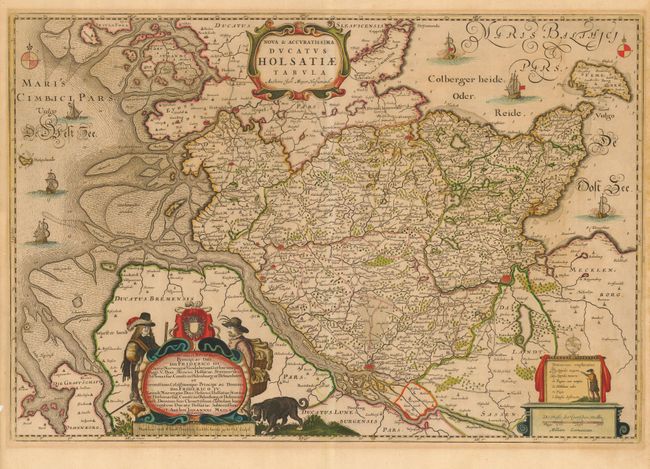
Subject: Germany

Period: 1652 (published)

Publication: Newe Landesbeschreibung ... Schleswig und Holstein

Color: Hand Color

Size:
24.5 x 16.6 inches
62.2 x 42.2 cm
Download High Resolution Image
(or just click on image to launch the Zoom viewer)

This superb map of northwestern Germany was drawn by Johannes Mejer. It is filled with exceptional detail of the topography, cites, villages, fortifications, roads, bridges, navigation channels, and much more. It is beautifully ornamented with sailing ships, compass roses and elaborate cartouches.

References:

Condition: B

Lovely original color. Lightly toned with a minor mat burn in blank margin.

Estimate: $400 - $500

Unsold

Closed on 9/28/2005

Archived