Subject: Greenland
Period: 1750 (circa)
Publication:
Color: Hand Color
Size:
11 x 5.5 inches
27.9 x 14 cm
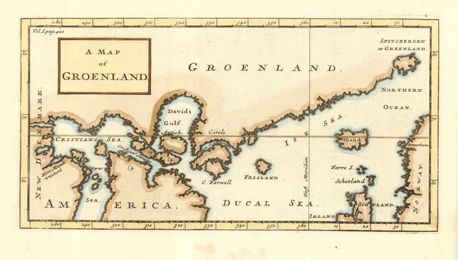
Interesting map of the southern coast of Greenland, locating Spitzberg, Iceland, and the mythical Frisland. Locates Davids Gulf, Cristians Sea, Ducal Sea, and the place where "Munk Wintered." This map is likely based on Churchill's "The Map of Groenland" published in 1704, which in turn was based in part on a map by Jens Munk. Munk led a Danish expedition in search of the Northwest Passage in 1619-20 and was the first to completely map Hudson Bay.
References:
Condition: A
Nice impression and coloring on hand laid paper with wide margins.