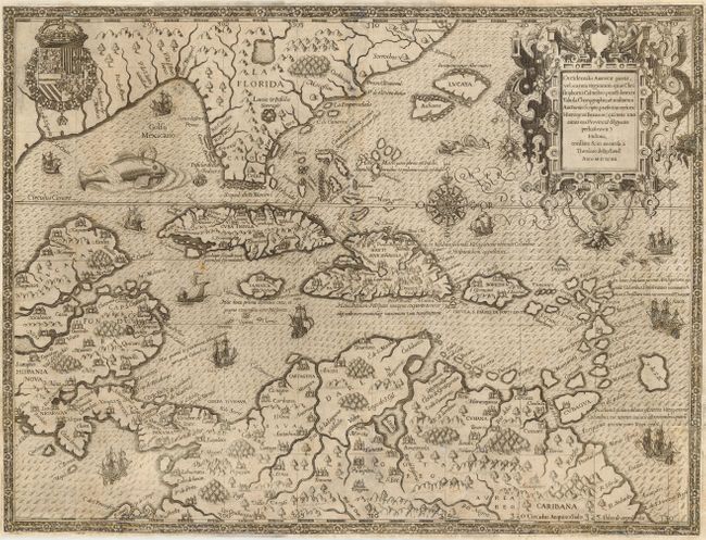
Subject: Caribbean
Period: 1594 (dated)
Publication: Grands Voyages, part IV
Color: Black & White
Size:
17.5 x 13 inches
44.5 x 33 cm
This spectacular map illustrates the region traveled by Girolamo Benzoni between the years 1541 and 1556. Centered on the disproportionately large islands of the Caribbean, the map also provides an early delineation of Florida derived from that of le Moyne and is one of the earliest maps to detail northern South America. The islands of the Bahamas are noticeably too large and placed considerably north of their true location. Various legends on the map mark the four voyages of Columbus and make an early mention of the Gulf Stream. De Bry's extraordinary engraving skill and artful style are very evident with the large elaborate cartouche, coat of arms, compass rose, sea monsters, Spanish galleon and intricate border.
References: Burden #83; Potter p.164.
Condition: B
Professionally and expertly repaired including some paper restoration and very skillful facsimile along the centerfold. The work is extremely well done and does not detract from the overall attractiveness of this rare map.