Catalog Archive
Auction 112, Lot 296

"[Lot of 5 - Puget Sound]", U.S. Government
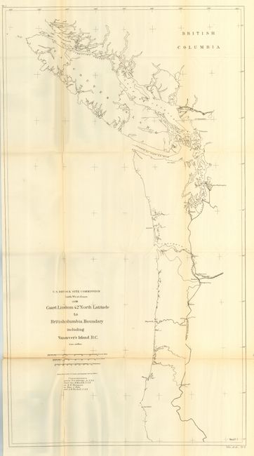
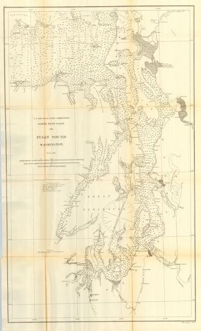
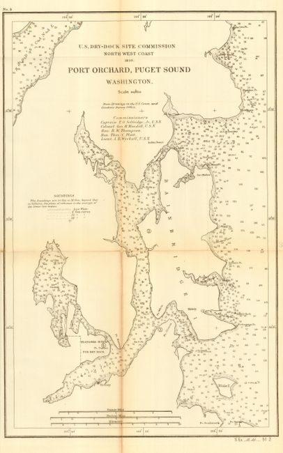
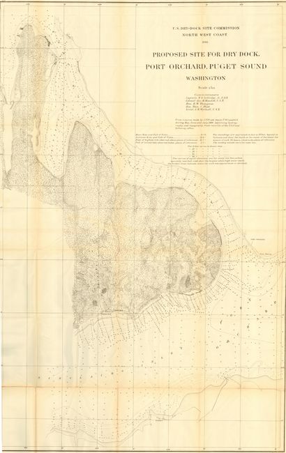
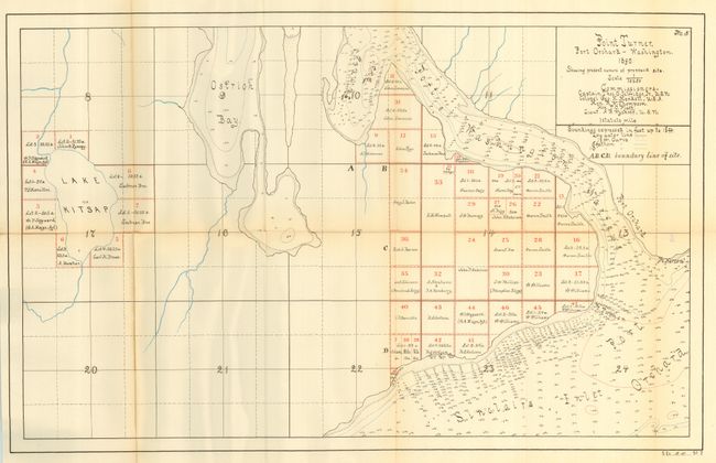
Subject: Washington

Period: 1890 (dated)

Publication: Sen. Ex Doc 24, 51st Cong., 2nd Sess.

Color: Black & White

Size:
See Description
Download High Resolution Image
(or just click on image to launch the Zoom viewer)

Set of related maps by the U.S. Drydock Commission from Coast and Geodetic Survey drawings. The set includes: 1) "Coast Line From 42° North Latitude To British Columbia Boundary Including Vancouver's Island B.C." (34.5 x 19"). 2) "Puget Sound/Washington" (35 x 20.8"). A general chart in sketch format that extends south to include Olympia and Tumwater. A large town southeast of Tacoma is named New Tacoma. 3) "Port Orchard, Puget Sound Washington" (11.5 x 17.7"). 4) "Proposed Site for Dry Dock Port Orchard, Puget Sound/Washington" (53 x 33.5"). The largest and most detailed chart in the set. Shows the proposed shipyard opposite of Port Orchard. 5) "Point Turner Port Orchard Washington 1890 Showing Present Owners of Proposed Site" (16 x 25.5") with some color. Very fine chart of Point Turner with plots and property owners detailed.

In 1888, Congress appointed a Commission of three naval officers to select a site for a naval shipyard and dry-dock in the Northwest. Following the inspection of several potential sites in Oregon and Washington, the commission recommended Point Turner near Port Orchard as the most suitable location for the new naval facility. Following the review by a second commission a final report was made to Congress, from which these maps were drawn. In March of 1891 Congress appropriated $10,000 to acquire 200 acres of land for the shipyard and dry-dock facility that became know as the Puget Sound Naval Shipyard, adjacent to Bremerton. A more in-depth history is available here. A nice set of related maps for which we found no references.

References:

Condition: B

Good impression and generally clean paper. Some light fold toning, and splits along some folds, else very good.