Subject: Minnesota
Period: 1849 (dated)
Publication: Senate Doc. 42, 3lst Cong. 1st Session
Color: Black & White
Size:
28 x 24.7 inches
71.1 x 62.7 cm
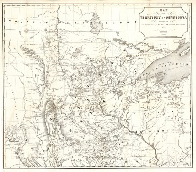
A foundation map for Minnesota from Pope's Report of an Exploration of the Territory of Minnesota and based on Nicollet's earlier "Map of the Hydrographical Basin of the Upper Mississippi River." Pope has increased the coverage to include the Lake of the Woods and Canada (British Possessions), and added much new information on rivers and lakes. This is considered the first published map to show the newly formed territory by itself. It details Pope's route from Fort Snelling to the Red River and back. Proposed lines of railroad grants are noted. Terrific detail of hydrography and topography. Drawn by P.S. Morawski.
References: Karrow No.7-0659; Phillips (M) p.432
Condition: A
Bright, early impression on clean paper. Issued folding, now pressed and backed with archival tissue. One very tiny area of loss at fold, one closed tear, else fine.