Subject: World
Period: 1646 (circa)
Publication:
Color: Black & White
Size:
14 x 10.5 inches
35.6 x 26.7 cm
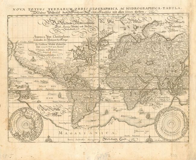
Merian based the cartography of this map on Blaeu's world map of 1606. Latin title at top, outside neatline. A German script title and notation concerning the discovery of the Americas in 1492 covers the unknown interior of North America. There is a large southern continent connected to New Guinea, California is a peninsula and there are plenty of open ended waterways in the eastern part of North America alluding to a possible Northwest Passage. Two polar projections occupy the lower corners. The map is richly decorated with numerous sea monsters, galleons and compass roses. First state with Merian's signature at bottom right.
References: Shirley #345.
Condition: B
A few stains and some professional repairs including paper restoration of right margin with facsimile of neatlines.