Subject: Hawaii
Period: 1903 (dated)
Publication:
Color: Printed Color
Size:
53.5 x 43.5 inches
135.9 x 110.5 cm
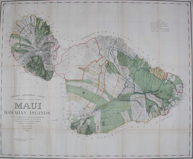
A large and handsome map that depicts Maui in great detail shortly after its annexation by the United States. Maui was the main island of the "county group" with a population approaching 40,000. Survey work during the previous decade had resulted in preparation of good maps, but there remained the problem of laying out the lands for settlement under existing land laws. This map delineates lands for sale, awarded lands, and much more. Made under the direction of W.D. Alexander, Surveyor General. Map drawn by F.S. Dodge, 1895, with topography by Alexander, Dodge, C.J. Lyons, M.D. Monsarrat, S.E. Bishop, E.D. Baldwin, and W.R. Lawrence. This example has been updated to 1903 by John M. Donn.
References:
Condition: B
Issued folding, now pressed and backed with archival tissue. Lightly toned along some folds, else very good to fine.