Subject: California - San Francisco
Period: 1849 (dated)
Publication: Senate Ex Doc 18, 31st Cong 1st Sess.
Color: Hand Color
Size:
19 x 24.8 inches
48.3 x 63 cm
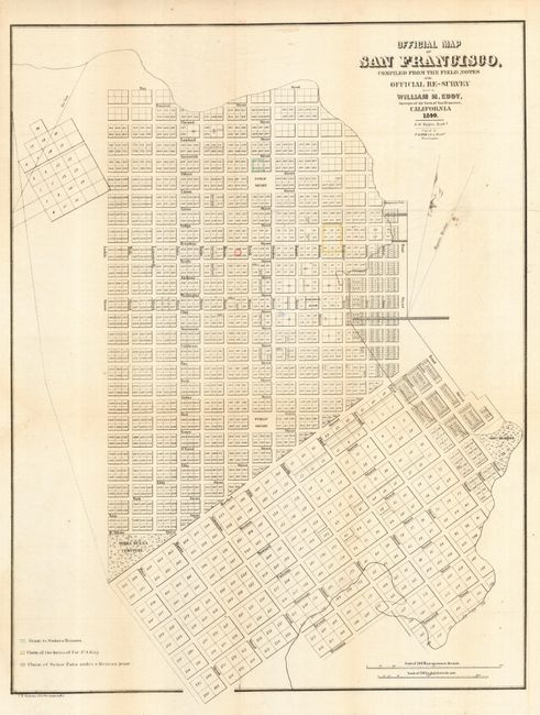
A scarce and seldom offered street map of San Francisco. Appears to be pre-landfill, with some planned tracts drawn in the bay. Terrific detail with individual tracts numbered and many streets named. Gives the location of the Yerba Buena Cemetery, a Government Reserve, two Public Squares and Fort Montgomery, but no buildings are shown. The map is mostly uncolored with a color legend, at lower left, keys to the map and locates a grant to Senora Briones, the claims of the heirs of Col. J. A. King and a claim of Senor Pana under a Mexican Grant. Two distance scales including varas to the inch. Attributed by Howes to the report "Land Titles in California" by William C. Jones. Howes notes that not all copies had this map. A rare and early city plan that was drawn by S. W. Higgins and printed by C.B. Graham. A very nice example.
References: Howes #248
Condition: A
Issued folding, now backed with tissue. Very light toning along some folds, still very good.