Subject: Southwestern United States
Period: 1864-72 (dated)
Publication:
Color: Hand Color
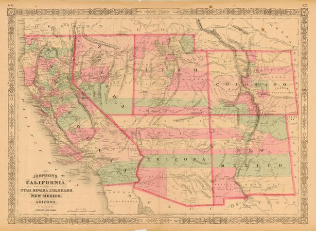
First (23.5 x 17") is the early 1864 edition in this series of maps published by Johnson and Ward in the New Illustrated Family Atlas, 1864. Arizona still has the county configurations of the old New Mexico Territory, with the addition of Castle Dome and Ewell counties in the south. The Utah/Nevada border is now at 115°. This is a completely new plate with much changed in watershed and mountain detail with several of the earlier notations removed. Details the U.S. Mail routes, the Emigrant roads to California, the proposed railroad route through Utah, Nevada and California, and the Pony Express trail.
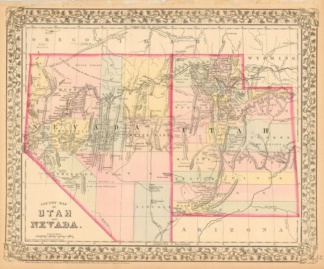
Second (14.3 x 11.8") is Mitchell's attractive map from the General Atlas, dated 1872. It shows the Central Pacific Railroad complete through the region and locates the Emigrant Road (Oregon Trail) and a planned wagon road from Red Bluffs to the Owyhee mines. Also locates Indian tribes, gold and silver mines, the Telegraph route and much more. Decorative grapevine border.
References:
Condition:
First, lightly toned with a bit of very minor foxing. Small chip in bottom margin, well away from map. Second very good with light toning in blank margins.