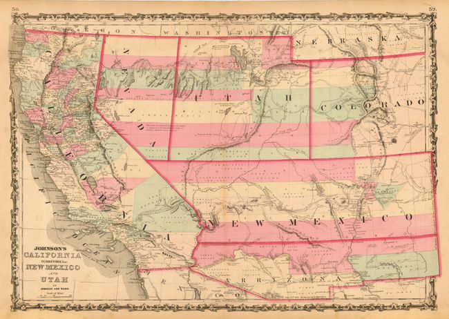
Subject: Southwestern United States
Period: 1862 (published)
Publication: New Illustrated Family Atlas
Color: Hand Color
Size:
24 x 17 inches
61 x 43.2 cm
One of the most desirable editions from this series. Arrizona shows up in the southern part of New Mexico Territory. This is thought to represent the Confederate Territory of Arizona that existed for nearly a year from August 1861 until July of 1862. The Confederate General Baylor appointed himself the territorial governor and claimed all of New Mexico Territory south of the 34th parallel. In the southern part of Arizona is the "Gadsden Ten Million Purchase of Mexico." The Utah/Nevada border follows the 116th meridian. Filled with historical notes and two interesting notations. One note in the area of Quartzite, Arizona refers to the area as being "exceedingly fertile and abundantly timbered and well watered." Details the U.S. Mail routes, the Emigrant road to California, the proposed railroad route through Utah, Nevada and California, and the Pony Express trail.
References:
Condition: B
Faint toning along centerfold and a couple marginal tears repaired with archival tape.