Subject: United States - Western
Period: 1887 (dated)
Publication: United States Pacific Railway Commission
Color: Printed Color
Size:
32.8 x 22.5 inches
83.3 x 57.2 cm
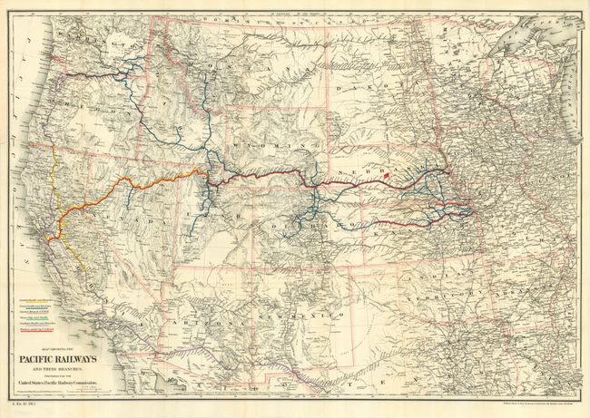
Map of the western United States showing relief by hachures, drainage, cities, towns, and the extensive railroad network that existed west of the Mississippi. The network is colored-coded to show the Union Pacific, Central Pacific, Central Branch U.P.R.R., Sioux City and Pacific, Southern Pacific, and Portions Aided by U.S. Bonds. This map shows the network at a time of rapid growth and prior to the business depression of 1893 that resulted in bankruptcy and reorganization of the Union Pacific Railroad Company. Terrific detail throughout. Published in Senate Document No. 51, 50th Congress, 1st Session.
References: Wheat (TMW) #1137; Phillips (A) #1388-23.
Condition: A
Beautiful example with dark, crisp impression and bright color. Folding, as issued. Very slightly toned along one fold, else fine.