Catalog Archive
Auction 112, Lot 180

"[Lot of 2] Map of the Chief Part of the Southern States and Part of the Western [and] Map of the New England or Eastern States", Mitchell, Samuel Augustus

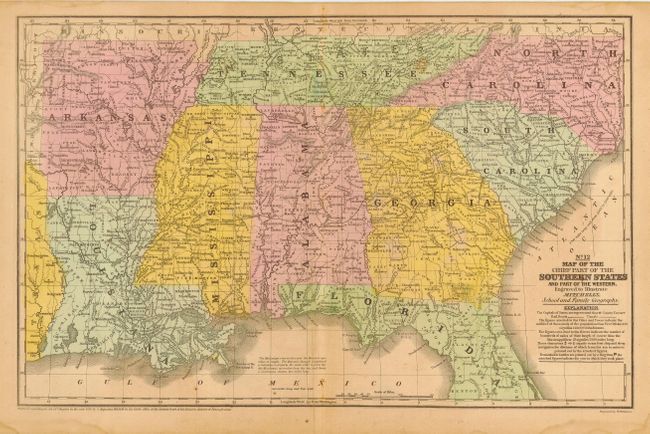
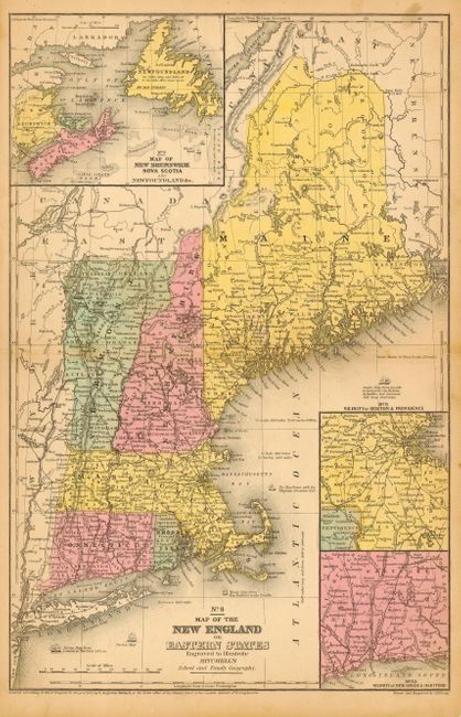
Subject: Eastern United States

Period: 1852-53 (dated)

Publication: Mitchell's School and Family Atlas

Color: Hand Color

Size:
16.5 x 10.5 inches
41.9 x 26.7 cm
Download High Resolution Image
(or just click on image to launch the Zoom viewer)

Both maps are double-page and are filled with a remarkable amount of information considering they are from a school atlas. Details include counties, Indian tribes and place names, watershed, counties, cities and towns, wagon roads or trails, and more. The first details the states of North & South Carolina, Georgia, Florida (down to Benton Country), Alabama, Mississippi, Louisiana, Arkansas, and Tennessee. The second shows Connecticut, Rhode Island, Massachusetts, Vermont, and Maine, with three insets: Vicinity of New Haven & Hartford, Vicinity of Boston & Providence, and Map of New Brunswick Nova Scotia and Newfoundland &c.

References:

Condition: B

Nice original coloring on sound paper with original margins. A few small spots on both maps, else very good. Student pencil marks on verso of first with no show through.

Estimate: $60 - $70

Unsold

Closed on 9/28/2005

Archived