Subject: Colonial Louisiana Territory
Period: 1762 (dated)
Publication:
Color: Black & White
Size:
15.4 x 15.6 inches
39.1 x 39.6 cm
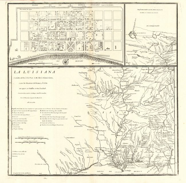
This rare map was published by one of the most distinguished Spanish cartographers of the eighteenth century. The map reflects a pivotal point in the history of the region when Louisiana became a Spanish colony at the end of the Seven Year's War. Lopez composed the sheet with three maps based on earlier French cartography. The main map (La Luisiana) draws on d'Anville's map of the region with excellent detail of the Mississippi and Ohio Rivers and the placement of Indian villages. Almost all of present-day Texas is included with the name Tejas prominently displayed. At upper right, Suplemento del Rio Misissipi, is also based on d'Anville and shows the supposed headwaters of the Mississippi River. The balance of the sheet forms a plan of New Orleans taken from Bellin.
References: Lemmon, Magill & Wiese #34; Lowery #467;
Streeter Sale, 6, #3913.
Condition: A
Weak impression in neatlines, else a strong impression. Faint toning along centerfold, still very good.