Catalog Archive
Auction 112, Lot 165

"A Map of that Part of America where a Degree of Latitude was Measured for the Royal Society: By Cha. Mason, & Jere. Dixon", Anon.

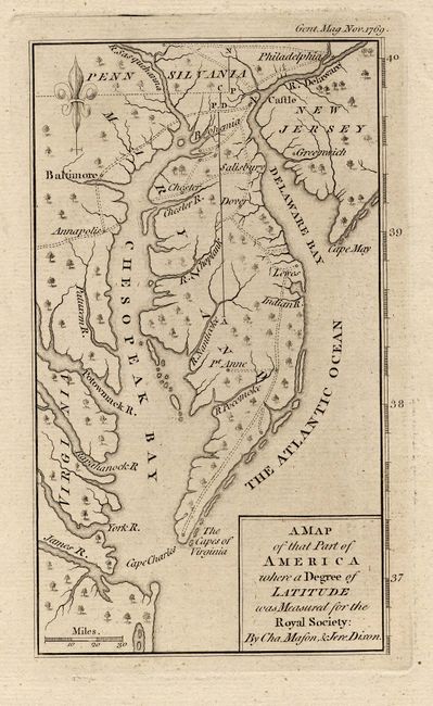
Subject: Colonial Mid-Atlantic

Period: 1769 (dated)

Publication: Gentleman's Magazine

Color: Black & White

Size:
3.8 x 6.5 inches
9.7 x 16.5 cm
Download High Resolution Image
(or just click on image to launch the Zoom viewer)

Shows the Delaware peninsula north to Philadelphia with only a few cities and roads including Annapolis, Baltimore, and Greenwich. The Mason-Dixon Line (as it was to become known) was the boundary between Maryland and Pennsylvania, surveyed in 1763 to 1767 by two British astronomers, Charles Mason and Jeremiah Dixon, in order to settle a dispute between the Calvert and Penn families. Very nice fleur-de-lys and simple block-style cartouche.

References: Jolly GENT-199.

Condition: A+

Estimate: $375 - $425

Sold for: $375

Closed on 9/28/2005

Archived