Subject: Colonial United States
Period: 1720 (circa)
Publication:
Color: Black & White
Size:
9 x 10.2 inches
22.9 x 25.9 cm
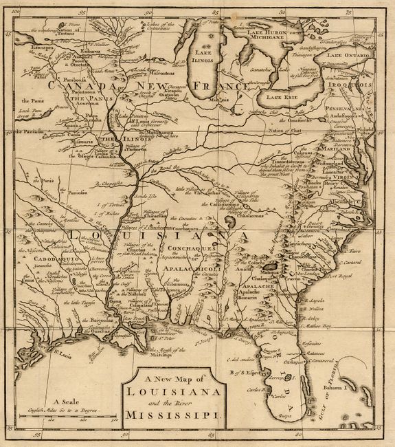
This interesting map focuses on the French empire in the heart of North America, embracing both the Great Lakes and the Mississippi Valley. It illustrates the French threat to the British colonies that are confined along the Atlantic seaboard by the Appalachian Ridge. French trading posts, lead mines, trails, and Indian villages are carefully noted and the Indian nations are prominently named. The Missouri River emanates from a great lake in the northwest that disappears off the map and another Great River flows west from Lack Pani; both alluding to the possibility of a passage to the Pacific.
This map appeared in either Smith's pamphlet, Some Considerations on the French Settling Colonies on the Mississippi [1720] or Ker's The Memoirs and Secret Negotiations of John Ker Containing Material on Louisiana and French Empire in America [1726], both of which contain essentially the same map but with slightly different cartouches. We have not been able to discern from which publication this map came.
References: cf. Cumming (SE) #176.
Condition: A
Issued folding, narrow (1/8") margin on binding side.