Subject: United States
Period: 1832 (dated)
Publication:
Color: Hand Color
Size:
15.8 x 12.7 inches
40.1 x 32.3 cm
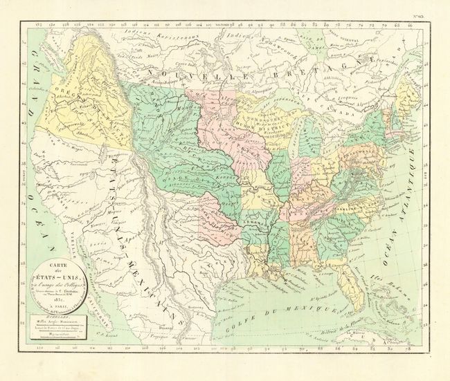
Boldly engraved copper plate map of the United States extending to include most of Cuba and the Bahamas. The map illustrated the westward expansion period of the United States with the United States extending into present-day Canada in the Oregon District, While Mexico still occupies California and the Southwest. Beyond Missouri and Arkansas, the West is filled with six Indian districts: Oregon, Mandan, Osage, Ozark, Huron and Sioux. The map is filled with place names, Indian villages, early mountains in the West, and more.
References:
Condition: A+
A lovely example with a dark impression and light pastel hand coloring. Full margins on fine hand laid paper with a rare script watermark.