Subject: United States
Period: 1820 (dated)
Publication:
Color: Hand Color
Size:
31.5 x 20 inches
80 x 50.8 cm
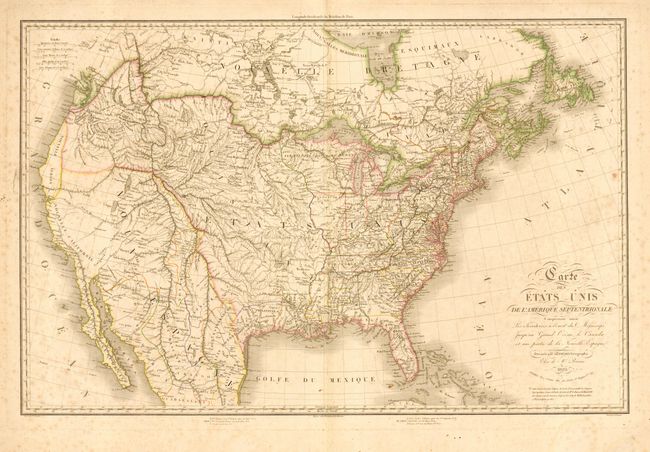
Fine French chart of the United States based on the map of Arrowsmith and Melish with information from the Lewis & Clark and Humbolt's expeditions. The map shows the United States' claims into present-day British Columbia. Spain controls New Mexico and California, including an unusual region of the Oregon coastline labeled Nouvelle Albion. Texas is shown to be a part of the United States and is labeled Nouvelles Philippines ou Texas, an unusual designation in the 19th century. The mapping of the west is particularly interesting for its unique novelty of a mountain range, Sierra San Marco, crossing the Nevada desert. Published by Poirson.
References: Wheat (TMW) #337.
Condition: B
Nice original outline color. Light scattered foxing and a few edge tears.