Catalog Archive
Auction 112, Lot 115

"Canada ou Nouvelle France Suivant les Nouvelles Observations de Messrs. de l'Academie Royale des Sciences etc.", Aa, Pieter van der

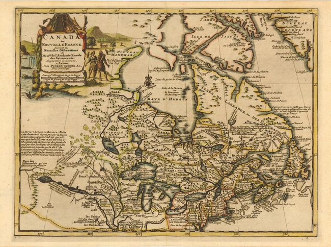
Subject: Colonial Canada and Great Lakes

Period: 1714 (circa)

Publication: Nouvel Atlas

Color: Hand Color

Size:
12 x 9 inches
30.5 x 22.9 cm
Download High Resolution Image
(or just click on image to launch the Zoom viewer)

Beautifully engraved map of northeastern North America and the Great Lakes region based on Delisle's important map of 1703. The Great Lakes are reasonably well delineated, but Hudson Bay and the upper Mississippi River basin are distorted. Lahontan's mythical Riviere Longue is shown linking a large western lake with the Mississippi River. It is thought that the lake's origin is derived from Indian stories concerning the Great Salt Lake. The map is filled with place names, Indian tribes and interesting notations. The large title cartouche is surrounded by scenes of natives and indigenous animals. This is the first state.

References: Kershaw #327.

Condition: A+

Estimate: $475 - $550

Sold for: $750

Closed on 9/28/2005

Archived