Subject: North America
Period: 1845 (circa)
Publication: Atlas National Illustre
Color: Hand Color
Size:
17 x 12 inches
43.2 x 30.5 cm
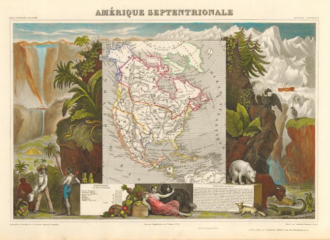
Victor Levasseur's "Atlas National Illustre" and "Atlas Universel Illustre" are among the last decorative atlases published. The maps are all lavishly illustrated with scenes of the countryside, products and activities indigenous to the region.
Lovely map featuring the Republic of Texas, the United States extending into present day Canada, Russia in control of Alaska and Mexico's northern border according to the Treaty of 1819 (mislabeled 1810). Surrounded by beautifully engraved scenes of North and Central America including local animals, a ship stranded in the polar sea, and a Mayan Temple.
References: Manasek #110.
Condition: A
Crisp, bright impression on heavy paper with full margins. Surrounding vignettes feature modern coloring, the map has its original outline coloring. A little creasing on verso of map, not visible from front.