Subject: South Pacific
Period:
Publication:
Color: Black & White
Nice group of Pacific exploration maps:
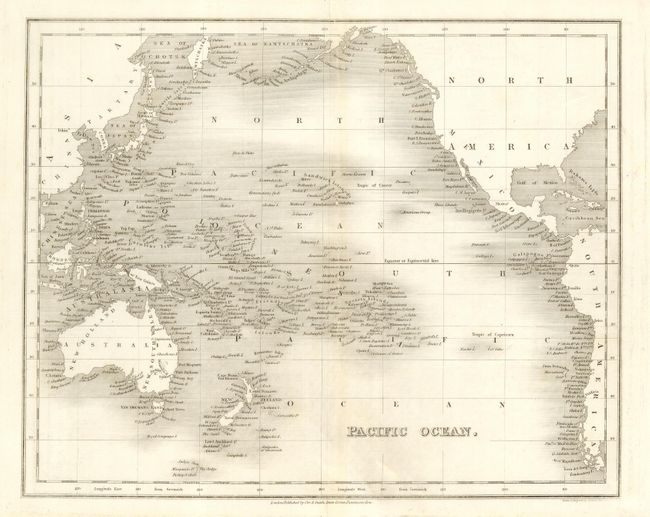
1) Pacific Ocean, J. Dower, c. 1840 (10.x x 8.2") A;
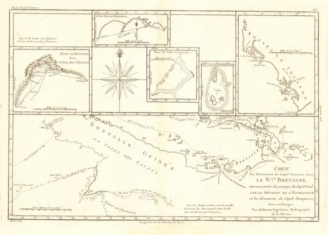
2) Carte des Decouvertes du Capite. Carteret dans la Nlle. Bretagne..…, Bonne, c. 1790 (13.6 x 9.1") A;
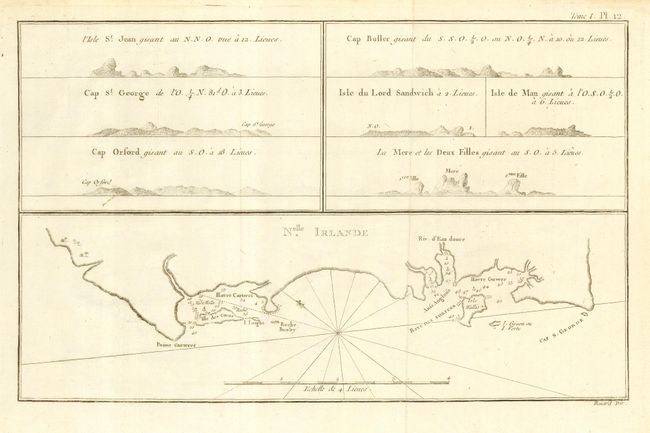
3) Nelle. Irlande, Benard, c. 1790 (12.7 x 7.9") A;
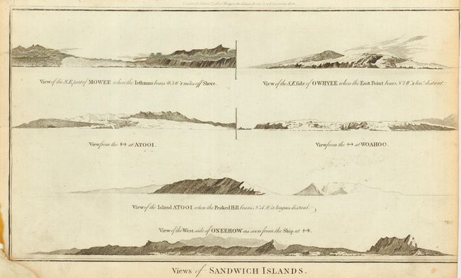
4) Views of Sandwich Islands, Cook/Hogg, c. 1790 (14.1 x 8") C - Trimmed into neatline at right and bottom left corner;
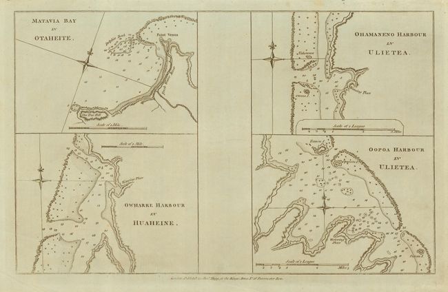
5) Matavia Bay in Otaheite / Owharre Harbour in Huaheine / Ohamaneno Harbour in Ulietea / Oopoa Harbour in Ulietea, Cook/Hogg, c. 1790 (13 x 8.1") A;
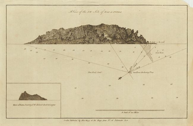
6) A View of the N.W. Side of Mas-a-Fuera, Cook/Hogg, c. 1790 (12.8 x 8") A - Creases in blank margins;
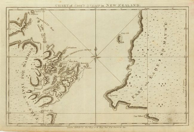
7) Chart of Cook's Strait in New Zeland, Cook/Hogg, c. 1790 (12.9 x 8.3") C - Light foxing and a puncture tear near center;
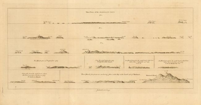
8) Untitled - Views of small Pacific Islands, Hawkesworth, 1772 (16.2 x 7") A;
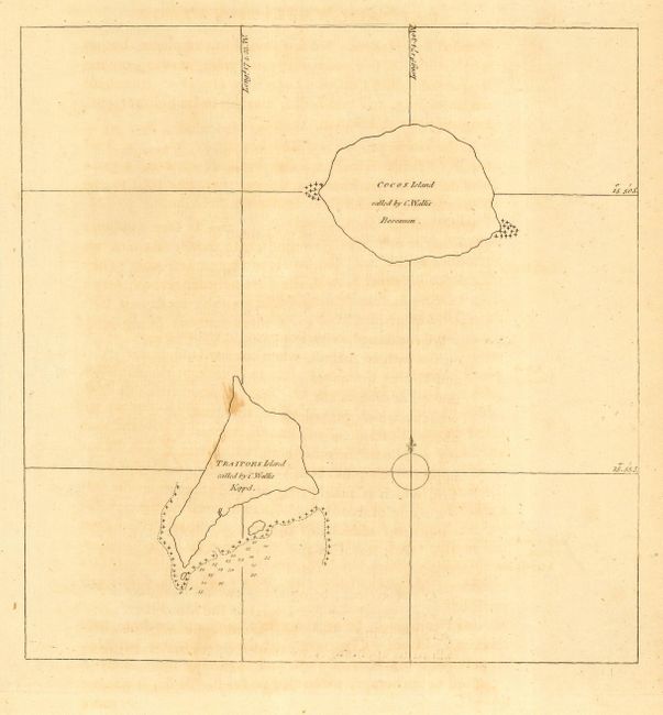
9) Untitled - Cocos Island and Traitors Island, Hawkesworth, c. 1772 (7.5 x 7.7") B.
References:
Condition:
Condition varies - see descriptions.