Subject: Asia
Period:
Publication:
Color:
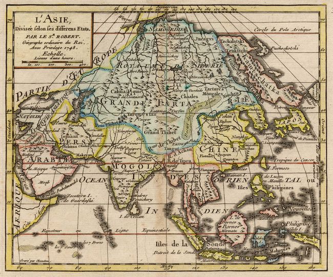
Two eighteenth century French maps of Asia. First (7.7 x 6.3") is a hand colored, copper engraving by Giles Robert de Vaugondy dated 1748 and published in the Atlas Portatif Universel et Militaire. This is a reduced version of his map of 1740 with reduced detail.
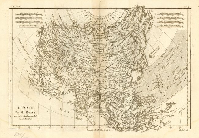
Second (12.7 x 9") is an uncolored, copper engraving by Rigobert Bonne, from Raynal's Atlas de Toutes les Parties Connues du Globe Terrestre, circa 1780. The outline of Asia follows the orthodox model for the period, with a few innovations. A group of islands to the east of Japan are noted as discovered in 1664 and 1716. Further north, another group of islands off the coast of Kamchatka is labeled the Archipel du Nord discovered in 1740. These are likely the Aleutian Islands, although their placement is too far to the west. The Carolines, or Nouvelle Philippines, are also misplaced too far to the west. The direction of the trade winds are marked and there is a good amount of detail throughout the map. Engraved by Andre.
References: Robert - Pedley #372; Bonne - Yeo #180.
Condition: B
Both lightly toned on centerfold. Light damp stains in lower corners of Bonne map.