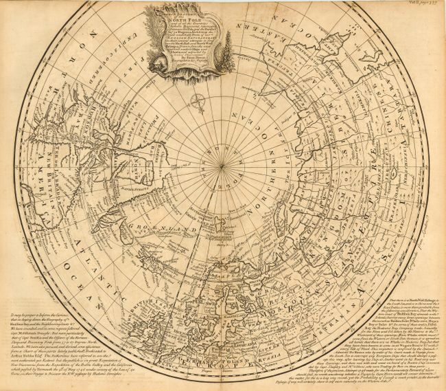
Subject: North Pole
Period: 1748 (circa)
Publication: A Complete Collection of Voyages…
Color: Black & White
Size:
17.2 x 15.5 inches
43.7 x 39.4 cm
A highly detailed map that shows the tracks of navigators in their numerous attempts to find the Northeast and Northwest Passages to the economic riches of Asia. Much of Greenland and the western part of North America remain undiscovered. A decorative title cartouche obscures the unknown Northwest coast. Panels of text at bottom. The map is accompanied by Pages 377-386 (5 leafs) of the original text, which contains fascinating information on "The History of the Countries lying round the North Pole; their Climate, Soil, and Produce; together with an Account of the Customs, Manners, and Trade of their Inhabitants."
References:
Condition: B
Trimmed just into neatline at top, as issued. Minor toning and offsetting, with short fold separations both top and bottom, just entering map. Remnants of hinge tape on verso.