Subject: Texas
Period: 1899 (dated)
Publication: Bulletin #190
Color: Printed Color
Size:
35.5 x 31 inches
90.2 x 78.7 cm
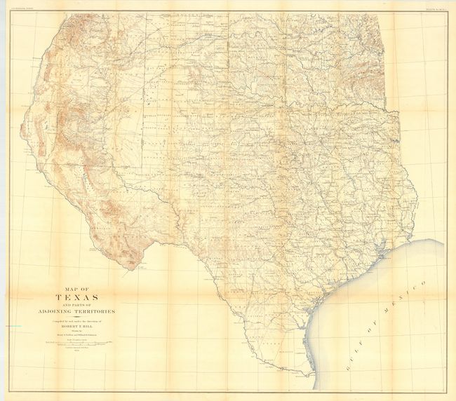
A large and extremely detailed map of the state that also includes most of Oklahoma and New Mexico east of the Rio Grande and south of Taos. Details counties, county seats, railroads, topographical and watershed. This map by Robert T. Hill, a widely known scholar, teacher and geologist, brought new sophistication to Texas cartography and helped set new scientific standards for the region's cartography. It was also published in "Topographical Atlas of the U.S., Physical geography of the Texas Region." Drawn by Henry Selden and Willard Johnson.
References: Martin & Martin, plate 50.
Condition: B
Issued folding, now backed with archival tissue. Lightly toned along some folds, else very good.