Catalog Archive
Auction 111, Lot 256

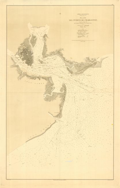
"America Septentrional Carolina del sur Plano del Puerto de Charleston", Spanish Admiralty

Subject: South Carolina

Period: 1864 (dated)

Publication:

Color: Hand Color

Size:
22.8 x 36.8 inches
57.9 x 93.5 cm
Download High Resolution Image
(or just click on image to launch the Zoom viewer)

Scarce, large-scale chart that shows in great detail Charleston, the Cooper and Ashley Rivers, and a large expanse of the harbor. It extends to include Monte Pleasant, Moultreville, Sullivan Island and includes hundreds of soundings, hazards, shoals, rocks, lighthouses, etc. This chart was produced during the period of the siege of Charleston during the Civil War. Drawn by P. Hortigosa with the embossed stamp "Direccion de Hidrografia - Madrid."

References:

Condition: B

Great impression on thick paper with full, original margins. Worm trail in lower blank area of map and a single small wormhole in map, else very good.

Estimate: $1,000 - $1,500

Sold for: $900

Closed on 6/8/2005

Archived