Catalog Archive
Auction 111, Lot 163

"Map of the West - Burlington Route", Railroad Companies, (Various)

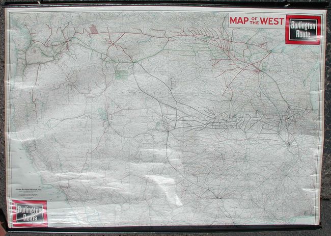
Subject: United States - Western

Period: 1940 (dated)

Publication:

Color: Printed Color

Size:
61.5 x 43 inches
156.2 x 109.2 cm
Download High Resolution Image
(or just click on image to launch the Zoom viewer)

This large wall map is a great example of charts published by railroad companies to promote their business. This map covers the western United States from Lake Michigan and Alabama in minute detail. It shows all the railroads including small feeder lines, train stations, roads, highways, national parks and monuments, and much more. Published by the Chicago, Burlington, & Quincy Railroad Co. with the stamp of the Denver Colorado shipping agent that distributed the map. Complete with original rollers.

References:

Condition: A+

Superb original condition.

Estimate: $200 - $300

Sold for: $120

Closed on 6/8/2005

Archived