Subject: Canada and Greenland
Period: 1607 (circa)
Publication: Histoire Universelle des Indes Occidentales et Orientales
Color: Hand Color
Size:
11.5 x 9 inches
29.2 x 22.9 cm
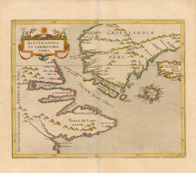
This fascinating map is from the first printed atlas relating exclusively to America. It is an important and influential map depicting the first detailed record of the discoveries of Davis and Frobisher in their search for the Northwest Passage. The attractive map has a stipple engraved sea and a decorative title cartouche. It is centered on the Davis Strait and depicts much of Greenland, Labrador, Iceland as well as the mythical island of Frisland. While both Frisland and Estotiland appeared on Mercator’s 1569 map, this is the first map to focus specifically on these locations. Frisland is remarkably detailed, with eleven settlements clearly marked. Other interesting features include the mysterious R. de Tormenta and "a furious over fall" emptying into the Davis Strait, which is the first indication of Hudson Strait, and is thought to have inspired Hudson in his search for a Northwest Passage at this location.
References: Burden #101; Kershaw #40.
Condition: A
Three very tiny wormholes professionally infilled.