Catalog Archive
Auction 110, Lot 421

"Nouvelle Carte des Cercles de l'Empire avec des Tables des Divers Souverains, Qui Composent ses Dietes et ses Differents Coleges", Chatelain, Henry Abraham

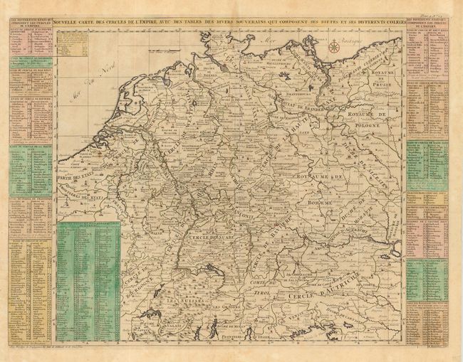
Subject: Europe - Central

Period: 1708 (published)

Publication: Atlas Historique et Methodique

Color: Hand Color

Size:
20 x 18 inches
50.8 x 45.7 cm
Download High Resolution Image
(or just click on image to launch the Zoom viewer)

A very detailed map of the German Empire with a list of it's important cities and nobility in tables at the sides. This handsome copper engraved map includes today's Germany, Switzerland, Austria, Holland, Belgium and Luxembourg.

References:

Condition: B

Full hand coloring of side panels, map uncolored less red icons indicating towns and villages. Good impression thick hand laid paper. Issued folding, now pressed. A few very light areas of toning, else very good.

Estimate: $180 - $220

Unsold

Closed on 3/2/2005

Archived