Subject: Colonial South
Period: 1679 (published)
Publication: Geographiae Universalis…
Color: Hand Color
Size:
4.8 x 3.7 inches
12.2 x 9.4 cm
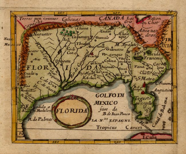
This miniature map of the Spanish possessions in North America covers the region south of the Great Lakes (Lac Erie) to the Gulf of Mexico and Florida. It is drawn from Nicolas Sanson's influential map (La Floride) of 1657. It differs from the folio map in the prominence given to the Rio del Spiritu Sto. over the other rivers flowing into the Mar Pequeno. Caroline (the old French Ft. Caroline) is located approximately at Port Royal in the region claimed by the French (Floride Francoise).
Pierre Duval was Nicolas Sanson's nephew and pupil. He published a wide range of atlases and individual maps including a fine miniature world geography with many of the maps based on Sanson. This map is from the German edition of Duval's world geography. The maps were probably engraved by Sigismund G. Hipschman (as his signature appears on the title page and the world map) and have Latin titles rather than the original French. The maps are often attributed to Johann C. Beer, who translated the work into German.
References: Burden #352; Cumming (SE) #86.
Condition: A
Lightly toned.