Catalog Archive
Auction 110, Lot 121

"Map of the United States in North America: with the British, French and Spanish Dominions adjoining, according to the Treaty of 1783", Kitchin, Thomas

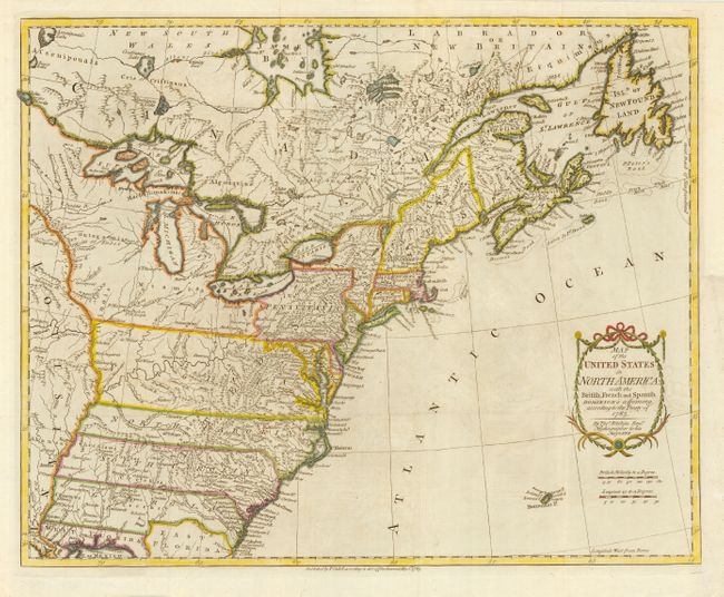
Subject: United States - Eastern

Period: 1783 (dated)

Publication: Raynal's Philosophical and Political History

Color: Hand Color

Size:
20 x 16 inches
50.8 x 40.6 cm
Download High Resolution Image
(or just click on image to launch the Zoom viewer)

This is one of the earliest English maps to officially acknowledge the United States. It depicts the new nation with its western border at the Mississippi River. The states of Georgia, South Carolina, North Carolina, and Virginia have their western boundaries on the Mississippi. The map is filled with information on early settlements, forts, Indian villages and fishing banks. The title is enclosed in a simple cartouche, below which is the island of Bermuda. Kitchin, Hydrographer to the King, prepared the map for a special publication by Thomas Cadell. It was subsequently issued in Raynal's history (1783-98) and possibly other publications.

References: McCorkle #783-11; Phillips (M) p. 862.

Condition: A

Folds reinforced with tissue on verso. Margin extended at binding trim to better accommodate framing.

Estimate: $1,000 - $1,200

Sold for: $3,500

Closed on 3/2/2005

Archived