Subject: North America
Period: 1781 (dated)
Publication: Atlas Portatif
Color: Hand Color
Size:
12.5 x 8.2 inches
31.8 x 20.8 cm
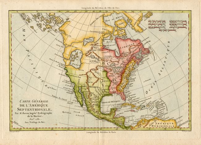
Great map of North America displaying some of the most intriguing cartographic mis-mapping of the late eighteenth century. The most apparent feature is the huge Mer de l' Ouest, complete with several fictitious islands, and with the fabled wealthy city of Quivira located on its southern shore. This sea is connected to the Pacific by the Entre of Jean de Fuca and the Entre de Martin d' Aguilar. In the middle of Canada is a gigantic Grande Eau from which flows the mythical R. de los Reyes (a remnant of the Northwest Passage theories). Also striking is the treatment of Alaska, shown as a vast group of island, the most prominent of which is named Alaschka.
References:
Condition: A
Overall very good with a couple of tiny unobtrusive spots.