Catalog Archive
Auction 109, Lot 91

"Amerique Septentrionale divisee en ses Principles Parties ou sont distingues les vns des autres les Estats suivant quils appartiennent presentemet aux Francois, Castillans, Anglois, Suedois, Danois Hollandois…", Sanson/Jaillot

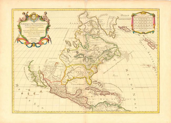
Subject: North America

Period: 1719 (dated)

Publication: Atlas Francois

Color: Hand Color

Size:
25.2 x 18 inches
64 x 45.7 cm
Download High Resolution Image
(or just click on image to launch the Zoom viewer)

Second state of this great map issued at the height of the California as an Island controversy. The first issue, in 1689, showed California clearly as an island with an indented northern coastline and Sanson's characteristic islands in the Mare Vermejo. In this edition, the map was updated but leaves the question of California's insularity open by eliminating the land to its north and west, but leaving a gap at the head of the Mare Vermejo. The Great Lakes are now shown complete and the Rio del Norte now flows correctly into the Gulf of Mexico. The lion's share of the United States is divided between Floride and Nouveau Mexique. Lovely title cartouche with Native Americans and tropical birds at upper left, balanced by the distance scale cartouche on right.

References: McLaughlin #101.

Condition: A

Near fine with minor repairs on centerfold.

Estimate: $1,700 - $2,000

Sold for: $2,000

Closed on 12/1/2004

Archived